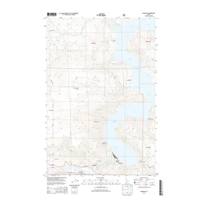
2014 Map of Ahsahka
USGS Topo · Published 2014About this map
Ahsahka stands at the confluence of the Clearwater River and the North Fork Clearwater River, a location defined by the monumental presence of the Dworshak Reservoir. This 2014 survey captures the landscape as a center for recreation and preservation, with the sprawling reservoir flooding the canyon behind the dam. The map details numerous campsites along the shoreline, including Big Eddy and Freeman Creek Campground, which serve visitors to this engineered waterway.
Find a feature on this map
34 named features on this map. Tap any name to fly to it.
Don’t see what you’re looking for? This feature index may not catch every label — zoom into the map to look around manually.
Map Details
Editions of this 2014 Ahsahka Map
This is the sole edition of this map. No revisions or reprints were ever made.
Other maps of this area

1924 · Kamiah
USGS Topo · 1:125,000

1955 · Pullman
USGS Topo · 1:250,000

1958 · Pullman
USGS Topo · 1:250,000

1961 · Ahsahka
USGS Topo · 1:62,500

1967 · Peck
USGS Topo · 1:24,000

1967 · Orofino West
USGS Topo · 1:24,000

1967 · Orofino East
USGS Topo · 1:24,000

1969 · Elk Creek Falls
USGS Topo · 1:24,000
1969 · Dent
USGS Topo · 1:24,000

1981 · Orofino
USGS Topo · 1:100,000