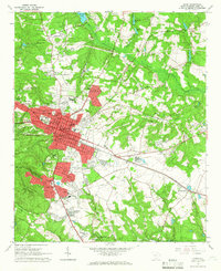
1964 Map of Aiken
USGS Topo · Published 1966About this map
Aiken serves as the focal point of this mid-1960s survey, revealing a landscape defined by its equine heritage and educational expansion. The presence of the Whitney Polo Field, a large steeplechase course, and the Polo Field south of the city center highlights the area's long-standing reputation as a winter colony for horse sports. Nearby, the established fairways of the Palmetto Golf Club and the Municipal Golf Course underscore the city's role as a recreational hub.
Find a feature on this map
112 named features on this map. Tap any name to fly to it.
Don’t see what you’re looking for? This feature index may not catch every label — zoom into the map to look around manually.
Map Details
Editions of this 1964 Aiken Map
4 editions found
Other maps of this area

1920 · Aiken
USGS Topo · 1:48,000

1920 · Talatha
USGS Topo · 1:48,000

1921 · Augusta
USGS Topo · 1:62,500

1921 · Aiken
USGS Topo · 1:62,500

1921 · Talatha
USGS Topo · 1:62,500

1923 · Warrenville
USGS Topo · 1:48,000

1928 · Warrenville
USGS Topo · 1:62,500

1943 · Aiken
USGS Topo · 1:62,500

1943 · Augusta East
USGS Topo · 1:125,000

1943 · Warrenville
USGS Topo · 1:62,500