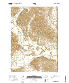
2020 Map of Airlie North
USGS Topo · Published 2020About this map
Lewisville and Airlie anchor this Polk County landscape, which is defined by a dense network of water management features and agricultural drainage. The Luckiamute River and its tributary, the Little Luckiamute River, wind through the southern half of the map, while the northern portion is marked by Gilliam Swale and Fishback Hill. Numerous private and agricultural water sources, such as Garber Reservoir, Fisher Reservoir, and McCrae Reservoir, dot the countryside, reflecting the area's intensive land use. For genealogists, the Butler Davidson Cem and Hart Riggs Cem provide specific points of historical interest. Small-scale aviation is represented by Marr Field and JPM Airport, tucked between established rural roads like Gilliam Rd and Ferns Corner Rd. The terrain transitions from the low-lying Cooper Hollow to the elevated ridges of the Coast Range foothills, showing the intersection of natural river courses and human-made reservoirs.
Find a feature on this map
71 named features on this map. Tap any name to fly to it.
Don’t see what you’re looking for? This feature index may not catch every label — zoom into the map to look around manually.
Map Details
Editions of this 2020 Airlie North Map
This is the sole edition of this map. No revisions or reprints were ever made.
Other maps of this area

1913 · Wells
USGS Topo · 1:31,680

1914 · Independence
USGS Topo · 1:31,680

1914 · Soap Creek
USGS Topo · 1:31,680

1915 · Rickreall
USGS Topo · 1:31,680

1916 · Albany
USGS Topo · 1:62,500

1917 · Salem
USGS Topo · 1:62,500

1921 · Corvallis
USGS Topo · 1:62,500

1922 · Airlie
USGS Topo · 1:31,680

1940 · Salem
USGS Topo · 1:62,500

1942 · Corvallis
USGS Topo · 1:62,500