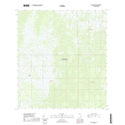
2018 Map of Airplane Prairie
USGS Topo · Published 2018About this map
Big Cypress National Preserve encompasses the vast majority of this landscape, revealing a mosaic of wetlands and prairie habitats in the modern era. The terrain is characterized by hydrological features like East Crossing Strand and Deep Lake Strand, which represent the natural flow patterns through the cypress swamps. Centrally located, the open expanse of Airplane Prairie stands out against the surrounding saturated environments, while Mud Lake marks the eastern edge of the survey area. This 2018 data provides a clear record of the preserve's ecosystem prior to more recent shifts in water management and conservation efforts, making it a foundational resource for understanding the contemporary geography of the Florida Everglades.
Find a feature on this map
8 named features on this map. Tap any name to fly to it.
Don’t see what you’re looking for? This feature index may not catch every label — zoom into the map to look around manually.
Map Details
Editions of this 2018 Airplane Prairie Map
This is the sole edition of this map. No revisions or reprints were ever made.
Other maps of this area

1956 · Miami
USGS Topo · 1:250,000

1956 · West Palm Beach
USGS Topo · 1:250,000

1957 · West Palm Beach
USGS Topo · 1:250,000

1958 · West Palm Beach
USGS Topo · 1:250,000

1958 · Miami
USGS Topo · 1:250,000

1959 · Miles City
USGS Topo · 1:24,000

1959 · Deep Lake
USGS Topo · 1:24,000

1972 · Monroe Station NE
USGS Topo · 1:24,000

1972 · Burns Lake
USGS Topo · 1:24,000

1972 · Ochopee
USGS Topo · 1:24,000