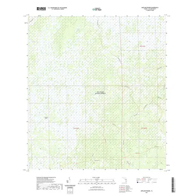
2021 Map of Airplane Prairie
USGS Topo · Published 2021About this map
Big Cypress National Preserve defines the landscape of this portion of Collier County, where the topography is shaped by slow-moving water and seasonal wetlands. The map illustrates a complex network of ecological corridors including Deep Lake Strand and East Crossing Strand, which represent the characteristic forested wetlands of the Florida Everglades ecosystem. The presence of Airplane Prairie indicates a distinctive opening in the cypress canopy, a feature often associated with slightly higher elevations or different soil compositions within the swamp.
Find a feature on this map
3 named features on this map. Tap any name to fly to it.
Don’t see what you’re looking for? This feature index may not catch every label — zoom into the map to look around manually.
Map Details
Editions of this 2021 Airplane Prairie Map
This is the sole edition of this map. No revisions or reprints were ever made.
Other maps of this area

1956 · Miami
USGS Topo · 1:250,000

1956 · West Palm Beach
USGS Topo · 1:250,000

1957 · West Palm Beach
USGS Topo · 1:250,000

1958 · West Palm Beach
USGS Topo · 1:250,000

1958 · Miami
USGS Topo · 1:250,000

1959 · Miles City
USGS Topo · 1:24,000

1959 · Deep Lake
USGS Topo · 1:24,000

1972 · Monroe Station NE
USGS Topo · 1:24,000

1972 · Burns Lake
USGS Topo · 1:24,000

1972 · Ochopee
USGS Topo · 1:24,000