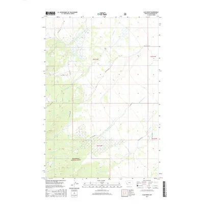
2017 Map of Ajax Ranch
USGS Topo · Published 2017About this map
Ajax Ranch sits within a network of mountain drainages and ranching corridors in southwestern Montana, where the terrain shifts toward the high country of the Beaverhead National Forest. This landscape is defined by its complex hydrology, with numerous streams like Slag-a-melt Creek and Big Swamp Creek flowing through the valley floors. The map reveals a land structured by water access and high-altitude grazing, with roads following the natural contours of the creeks. Notable thoroughfares such as Twin Lakes Road and Big Lake Creek Road provide access into the more remote reaches of the forest. The presence of Sawmill Creek suggests the historical importance of timber resources, while ranching labels like Dillana Ranch Road underscore the enduring agricultural use of this high-elevation basin near the Continental Divide.
Find a feature on this map
22 named features on this map. Tap any name to fly to it.
Don’t see what you’re looking for? This feature index may not catch every label — zoom into the map to look around manually.
Map Details
Editions of this 2017 Ajax Ranch Map
This is the sole edition of this map. No revisions or reprints were ever made.
Other maps of this area

1955 · Dillon
USGS Topo · 1:250,000

1957 · Dillon
USGS Topo · 1:250,000

1958 · Dillon
USGS Topo · 1:250,000

1962 · Dillon
USGS Topo · 1:250,000

1962 · Wisdom
USGS Topo · 1:24,000

1965 · Dillon
USGS Topo · 1:250,000

1966 · Miner Lake
USGS Topo · 1:24,000

1966 · Jumbo Mountain
USGS Topo · 1:24,000
1966 · Ajax Ranch
USGS Topo · 1:24,000
1966 · Highland Ranch
USGS Topo · 1:24,000