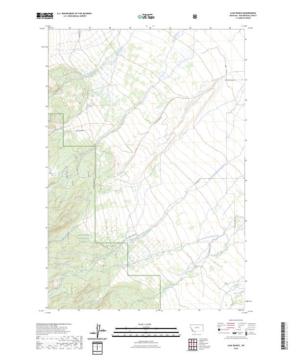
2024 Map of Ajax Ranch
USGS Topo · Published 2024About this map
Beaverhead National Forest covers the southwestern portion of this map, where the terrain transitions into a complex drainage system of high-altitude creeks. Notable waterways like Sawmill Creek and Slag-a-melt Creek feed into the broader basin of Big Swamp Creek, illustrating the intricate hydrological network of this Montana landscape. The map's labeling reveals a pattern of ranching and land use supported by a network of local roads such as Big Lake Creek Rd and Diltana Ranch Rd.
Find a feature on this map
22 named features on this map. Tap any name to fly to it.
Don’t see what you’re looking for? This feature index may not catch every label — zoom into the map to look around manually.
Map Details
Editions of this 2024 Ajax Ranch Map
This is the sole edition of this map. No revisions or reprints were ever made.
Other maps of this area

1955 · Dillon
USGS Topo · 1:250,000

1957 · Dillon
USGS Topo · 1:250,000

1958 · Dillon
USGS Topo · 1:250,000

1962 · Dillon
USGS Topo · 1:250,000

1962 · Wisdom
USGS Topo · 1:24,000

1965 · Dillon
USGS Topo · 1:250,000

1966 · Miner Lake
USGS Topo · 1:24,000

1966 · Jumbo Mountain
USGS Topo · 1:24,000
1966 · Ajax Ranch
USGS Topo · 1:24,000
1966 · Highland Ranch
USGS Topo · 1:24,000