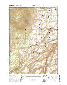
2017 Map of Akawa Butte
USGS Topo · Published 2017About this map
Akawa Butte rises as a prominent landmark at the northern edge of the Deschutes National Forest, marking a landscape where high desert meets protected timberlands. The small settlement of Geneva sits near the eastern boundary, while the surrounding terrain is defined by a series of deep drainage systems including Stevens Canyon, Fremont Canyon, and Trahan Canyon. The map reveals the intricate administrative boundary between the forest and the Crooked River National Grassland, where the land descends into the dramatic depths of the Whychus Creek Canyon along Whychus Cr. A network of forest development roads and local routes like SW Grandview Loop Rd connects these disparate topographic features, tracing the paths once used for ranching and resource management. Notable depressions like Dry Lake and named points like Tai Flat further illustrate the high-plateau character of this central Oregon borderland.
Find a feature on this map
39 named features on this map. Tap any name to fly to it.
Don’t see what you’re looking for? This feature index may not catch every label — zoom into the map to look around manually.
Map Details
Editions of this 2017 Akawa Butte Map
This is the sole edition of this map. No revisions or reprints were ever made.
Other maps of this area

1926 · Bend
USGS Topo · 1:125,000

1927 · Mt. Jefferson
USGS Topo · 1:125,000

1928 · Madras
USGS Topo · 1:125,000

1929 · Bend
USGS Topo · 1:125,000

1929 · Three Sisters
USGS Topo · 1:125,000

1930 · Mt. Jefferson
USGS Topo · 1:125,000

1931 · Madras
USGS Topo · 1:125,000

1932 · Three Sisters
USGS Topo · 1:125,000

1955 · Bend
USGS Topo · 1:250,000

1957 · Bend
USGS Topo · 1:250,000