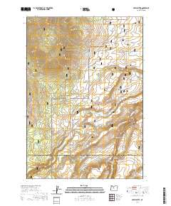
2020 Map of Akawa Butte
USGS Topo · Published 2020About this map
Akawa Butte dominates the northern landscape of this Central Oregon region where the high desert meets managed forest and grassland. The boundary between the Deschutes National Forest and the Crooked River National Grassland bisects the area, illustrating the transition from timbered slopes to open range. In the northeast, the small settlement of Geneva sits near the edge of the Lower Desert, reflecting the remote ranching and farming history of the plateau. To the south, the terrain is deeply carved by water, most notably at Whychus Creek Canyon and the nearby Fremont Canyon. The network of forest and local roads, such as SW Grandview Loop Rd and SW Black Butte Rd, connects these canyons with geographic landmarks like Tai Flat and the ephemeral Dry Lake.
Find a feature on this map
28 named features on this map. Tap any name to fly to it.
Don’t see what you’re looking for? This feature index may not catch every label — zoom into the map to look around manually.
Map Details
Editions of this 2020 Akawa Butte Map
This is the sole edition of this map. No revisions or reprints were ever made.
Other maps of this area

1926 · Bend
USGS Topo · 1:125,000

1927 · Mt. Jefferson
USGS Topo · 1:125,000

1928 · Madras
USGS Topo · 1:125,000

1929 · Bend
USGS Topo · 1:125,000

1929 · Three Sisters
USGS Topo · 1:125,000

1930 · Mt. Jefferson
USGS Topo · 1:125,000

1931 · Madras
USGS Topo · 1:125,000

1932 · Three Sisters
USGS Topo · 1:125,000

1955 · Bend
USGS Topo · 1:250,000

1957 · Bend
USGS Topo · 1:250,000