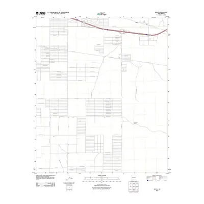
2010 Map of Akela
USGS Topo · Published 2010About this map
Akela Flats defines this portion of the New Mexico desert, where the settlement of Akela sits at the junction of modern infrastructure and a developing grid of named roads. The geography is characterized by a sprawling network of planned residential or agricultural thoroughfares, including many Spanish-named routes such as El Ensueno Rd Se and El Bordo Rd Se, which contrast with the industrial presence of the Pipeline Rd. Outside the main transportation corridor near the Akela Interchange, the landscape remains largely open. Scattered landmarks like the Matamoros Windmill serve as essential water sources for cattle or residents in this arid environment. This 2010 survey provides a detailed look at the rural transition between the high desert plains and the growing footprints of local development along Vibora Rd and Micro Rd Se.
Find a feature on this map
78 named features on this map. Tap any name to fly to it.
Don’t see what you’re looking for? This feature index may not catch every label — zoom into the map to look around manually.
Map Details
Editions of this 2010 Akela Map
This is the sole edition of this map. No revisions or reprints were ever made.
Other maps of this area

1899 · Deming
USGS Topo · 1:125,000

1915 · Deming
USGS Topo · 1:125,000

1955 · Las Cruces
USGS Topo · 1:250,000

1958 · Las Cruces
USGS Topo · 1:250,000

1964 · Gym Peak
USGS Topo · 1:24,000

1964 · Florida Gap
USGS Topo · 1:24,000

1965 · Carne
USGS Topo · 1:24,000

1972 · Myndus
USGS Topo · 1:24,000

1972 · Cambray
USGS Topo · 1:24,000
1972 · X-7 Ranch
USGS Topo · 1:24,000