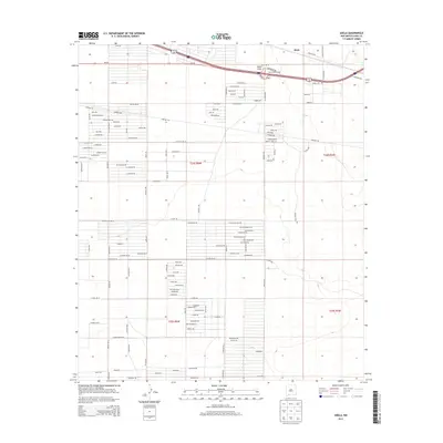
2013 Map of Akela
USGS Topo · Published 2013About this map
Akela Flats dominate this high-desert landscape in Luna County, where the settlement of Akela serves as a primary waypoint along the transportation corridor. This 2013 survey reveals an intricate network of local desert roads such as Lemitar Rd and Vibora Rd, alongside a grid of residential or agricultural planned streets with botanical names like Saguaro Rd, Cholla Rd, and Prickly Pear Rd. The infrastructure is anchored by the Akela Interchange, providing a vital link for travelers passing through this arid basin. A significant Pipeline Rd cuts across the terrain, reflecting the region's industrial utility footprint alongside the more traditional ranching or homesteading road patterns seen in the various townships of the Public Land Survey System.
Find a feature on this map
100 named features on this map. Tap any name to fly to it.
Don’t see what you’re looking for? This feature index may not catch every label — zoom into the map to look around manually.
Map Details
Editions of this 2013 Akela Map
This is the sole edition of this map. No revisions or reprints were ever made.
Other maps of this area

1899 · Deming
USGS Topo · 1:125,000

1915 · Deming
USGS Topo · 1:125,000

1955 · Las Cruces
USGS Topo · 1:250,000

1958 · Las Cruces
USGS Topo · 1:250,000

1964 · Gym Peak
USGS Topo · 1:24,000

1964 · Florida Gap
USGS Topo · 1:24,000

1965 · Carne
USGS Topo · 1:24,000

1972 · Myndus
USGS Topo · 1:24,000

1972 · Cambray
USGS Topo · 1:24,000
1972 · X-7 Ranch
USGS Topo · 1:24,000