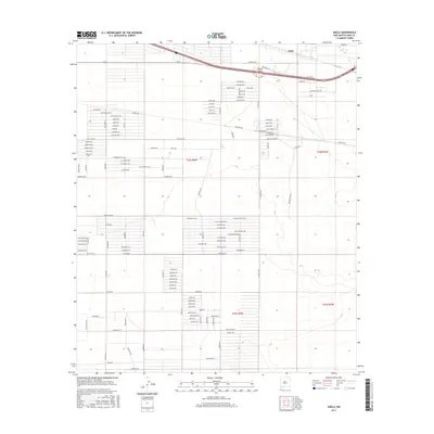
2017 Map of Akela
USGS Topo · Published 2017About this map
Akela and the surrounding Akela Flats define this stretch of the Chihuahuan Desert landscape in Luna County. The settlement pattern here is characterized by a dense grid of named roads and residential avenues, reflecting late-twentieth and early-twenty-first-century desert development. Many streets are named for local flora, such as Prickly Pear Rd, Saguaro Rd, Ocotillo Rd, and Ironwood Rd. Transport is centered on the Frontage Rd and its connection to the regional highway system, which cuts across the northern section of the map. While the terrain appears relatively flat, the map provides a look at how this arid environment was organized into specific blocks and avenues like Happiness Ave Se and Solana Rd Se, providing valuable context for understanding modern New Mexico land division and desert habitation.
Find a feature on this map
97 named features on this map. Tap any name to fly to it.
Don’t see what you’re looking for? This feature index may not catch every label — zoom into the map to look around manually.
Map Details
Editions of this 2017 Akela Map
This is the sole edition of this map. No revisions or reprints were ever made.
Other maps of this area

1899 · Deming
USGS Topo · 1:125,000

1915 · Deming
USGS Topo · 1:125,000

1955 · Las Cruces
USGS Topo · 1:250,000

1958 · Las Cruces
USGS Topo · 1:250,000

1964 · Gym Peak
USGS Topo · 1:24,000

1964 · Florida Gap
USGS Topo · 1:24,000

1965 · Carne
USGS Topo · 1:24,000

1972 · Myndus
USGS Topo · 1:24,000

1972 · Cambray
USGS Topo · 1:24,000
1972 · X-7 Ranch
USGS Topo · 1:24,000