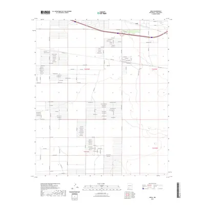
2023 Map of Akela
USGS Topo · Published 2023About this map
The high desert landscape of Akela and Akela Flats is defined by a rigorous grid of named residential and ranch roads that stretch across the New Mexico terrain. This network, including uniquely named thoroughfares such as La Susida Rd, El Bordo Rd SE, and Boothill Rd SE, suggests a planned desert development or rural settlement pattern centered along the Interstate corridor. The map labels reflect the local flora and geography with routes like Cholla Rd, Saguaro Rd, and Prickly Pear Rd. The southern reach of the quadrangle includes Cam Nueve, indicating the expansion of rural addresses away from the primary transport arteries into the open flats of the Chihuahuan Desert environment.
Find a feature on this map
98 named features on this map. Tap any name to fly to it.
Don’t see what you’re looking for? This feature index may not catch every label — zoom into the map to look around manually.
Map Details
Editions of this 2023 Akela Map
This is the sole edition of this map. No revisions or reprints were ever made.
Other maps of this area

1899 · Deming
USGS Topo · 1:125,000

1915 · Deming
USGS Topo · 1:125,000

1955 · Las Cruces
USGS Topo · 1:250,000

1958 · Las Cruces
USGS Topo · 1:250,000

1964 · Gym Peak
USGS Topo · 1:24,000

1964 · Florida Gap
USGS Topo · 1:24,000

1965 · Carne
USGS Topo · 1:24,000

1972 · Myndus
USGS Topo · 1:24,000

1972 · Cambray
USGS Topo · 1:24,000
1972 · X-7 Ranch
USGS Topo · 1:24,000