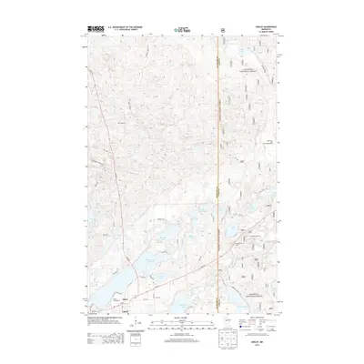
2013 Map of Akeley
USGS Topo · Published 2013About this map
The town of Akeley sits at the southwestern edge of this Hubbard County landscape, serving as a gateway to the dense woodlands of the Chippewa National Forest. The map reveals a post-glacial terrain defined by an intricate network of water bodies, including the sprawling Eleventh Crow Wing Lake and the chain of smaller lakes like Rickles Lake, Little Bass Lake, and Lake Bess. This geography fostered a strong recreational and timber-focused economy, evident in the numerous forest roads like Parkway Forest Rd and Steamboat Forest Rd that cut through the undulating hills.
Find a feature on this map
55 named features on this map. Tap any name to fly to it.
Don’t see what you’re looking for? This feature index may not catch every label — zoom into the map to look around manually.
Map Details
Editions of this 2013 Akeley Map
This is the sole edition of this map. No revisions or reprints were ever made.
Other maps of this area

1953 · Brainerd
USGS Topo · 1:250,000

1954 · Bemidji
USGS Topo · 1:250,000

1957 · Brainerd
USGS Topo · 1:250,000

1957 · Bemidji
USGS Topo · 1:250,000

1958 · Bemidji
USGS Topo · 1:250,000

1958 · Brainerd
USGS Topo · 1:250,000

1965 · Brainerd
USGS Topo · 1:250,000

1970 · Hackensack
USGS Topo · 1:24,000

1970 · Nevis
USGS Topo · 1:24,000
1970 · Crystal Lake
USGS Topo · 1:24,000