
1970 Map of Nevis
USGS Topo · Published 1972About this map
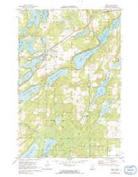
The village of Nevis serves as the focal point of this 1970 Hubbard County survey, situated along the Burlington Northern railroad corridor. This landscape is defined by the elaborate chain of the Crow Wing river system, with Ninth Crow Wing Lake, Eighth Crow Wing Lake, and Seventh Crow Wing Lake cutting through the center of the quadrangle. The map reveals a transition from the structured street grid and local services of the town center, including the Lakeview Cem and a nearby Landing Field, to the more expansive woodlands of the Badoura State Forest in the southeast. Local infrastructure is evidenced by the numerous gravel pits and the presence of a Townhall near the Lemon Cem, reflecting the small-town administrative and resource-based economy of the era. Smaller, secluded water bodies like Holland-Lucy Lake and Spider Lake dot the north, illustrating the dense glacial hydrology typical of northern Minnesota.
Find a feature on this map
36 named features on this map. Tap any name to fly to it.
Don’t see what you’re looking for? This feature index may not catch every label — zoom into the map to look around manually.
Map Details
Editions of this 1970 Nevis Map
2 editions found
Other maps of this area

1953 · Brainerd
USGS Topo · 1:250,000

1954 · Bemidji
USGS Topo · 1:250,000

1957 · Brainerd
USGS Topo · 1:250,000

1957 · Bemidji
USGS Topo · 1:250,000

1958 · Bemidji
USGS Topo · 1:250,000

1958 · Brainerd
USGS Topo · 1:250,000

1965 · Brainerd
USGS Topo · 1:250,000

1970 · Dorset
USGS Topo · 1:24,000
1970 · Huntersville
USGS Topo · 1:24,000
1970 · Oshawa
USGS Topo · 1:24,000