
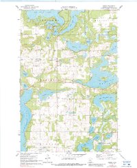
1970 Map of Dorset
USGS Topo · Published 1972About this map
Dorset sits at the heart of this Hubbard County landscape, serving as a central hub between the expansive Lake Belle Taine and Big Sand Lake. The area is defined by an intricate glacial geography of interconnected water bodies, including Lake Emma, Mantrap Lake, and the winding Crow Wing River. Transportation in the early 1970s was anchored by the Burlington Northern railroad line, which passes through the center of the township near the Dorset Lookout Tower. Cultural markers such as Henrietta Cem and Bethel Cem provide critical points of reference for genealogists tracking early residents in Henrietta and Hubbard. This survey captures the region as a primary recreational and timber landscape, dotted with features like the Roadside Park and numerous family-named landmarks including Peysenske Lake and Clausens Lake.
Find a feature on this map
40 named features on this map. Tap any name to fly to it.
Don’t see what you’re looking for? This feature index may not catch every label — zoom into the map to look around manually.
Map Details
Editions of this 1970 Dorset Map
2 editions found
Other maps of this area

1953 · Brainerd
USGS Topo · 1:250,000

1954 · Bemidji
USGS Topo · 1:250,000

1957 · Brainerd
USGS Topo · 1:250,000

1957 · Bemidji
USGS Topo · 1:250,000

1958 · Bemidji
USGS Topo · 1:250,000

1958 · Brainerd
USGS Topo · 1:250,000

1965 · Brainerd
USGS Topo · 1:250,000

1969 · Park Rapids
USGS Topo · 1:24,000

1969 · Menahga
USGS Topo · 1:24,000

1970 · Nevis
USGS Topo · 1:24,000