
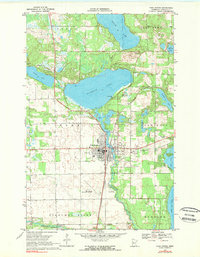
1969 Map of Park Rapids
USGS Topo · Published 1971About this map
Park Rapids sits at the center of this Hubbard County survey, serving as a hub for the surrounding lakeland at the end of the 1960s. The settlement is defined by its relationship to water, positioned where Fishhook Lake feeds into the Fishhook River. The local infrastructure reflects a mid-century community in transition, showing the Burlington Northern railroad corridor alongside recreational landmarks like the Headwaters Country Club and the Drive-in Theater east of town.
Find a feature on this map
41 named features on this map. Tap any name to fly to it.
Don’t see what you’re looking for? This feature index may not catch every label — zoom into the map to look around manually.
Map Details
Editions of this 1969 Park Rapids Map
2 editions found
Other maps of this area

1953 · Brainerd
USGS Topo · 1:250,000

1954 · Bemidji
USGS Topo · 1:250,000

1957 · Brainerd
USGS Topo · 1:250,000

1957 · Bemidji
USGS Topo · 1:250,000

1958 · Bemidji
USGS Topo · 1:250,000

1958 · Brainerd
USGS Topo · 1:250,000

1965 · Brainerd
USGS Topo · 1:250,000

1969 · Menahga
USGS Topo · 1:24,000

1969 · Park Rapids SW
USGS Topo · 1:24,000
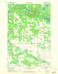
1969 · Park Rapids NW
USGS Topo · 1:24,000