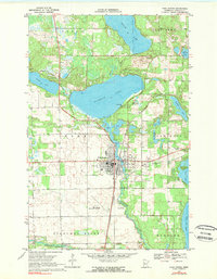
1969 Map of Park Rapids
USGS Topo · Published 1980About this map
Park Rapids serves as the focal point for this Hubbard County landscape, where the confluence of the Fishhook River and Straight River shaped the local economy and layout. The town is flanked by significant water bodies, notably Fishhook Lake and Potato Lake, which support a mix of seasonal and year-round residences including a Trailer Park. The infrastructure of the late 1960s is well-documented, showing the Burlington Northern railroad corridor and the Park Rapids Municipal Airport.
Find a feature on this map
38 named features on this map. Tap any name to fly to it.
Don’t see what you’re looking for? This feature index may not catch every label — zoom into the map to look around manually.
Map Details
Editions of this 1969 Park Rapids Map
2 editions found
Other maps of this area

1953 · Brainerd
USGS Topo · 1:250,000

1954 · Bemidji
USGS Topo · 1:250,000

1957 · Brainerd
USGS Topo · 1:250,000

1957 · Bemidji
USGS Topo · 1:250,000

1958 · Bemidji
USGS Topo · 1:250,000

1958 · Brainerd
USGS Topo · 1:250,000

1965 · Brainerd
USGS Topo · 1:250,000

1969 · Park Rapids
USGS Topo · 1:24,000

1969 · Menahga
USGS Topo · 1:24,000

1969 · Park Rapids SW
USGS Topo · 1:24,000