
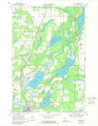
1969 Map of Menahga
USGS Topo · Published 1971About this map
The Burlington Northern railroad corridor anchors the western landscape of this late 1960s survey, running through the heart of Menahga and northward past Horton. The topography is defined by an intricate network of glacial water bodies and marshes, including the expansive Blueberry Lake and the winding Straight River. Near the corporate boundary of Menahga, a Campground and Spirit Lake mark the local recreational footprint of the era.
Find a feature on this map
27 named features on this map. Tap any name to fly to it.
Don’t see what you’re looking for? This feature index may not catch every label — zoom into the map to look around manually.
Map Details
Editions of this 1969 Menahga Map
2 editions found
Other maps of this area

1953 · Brainerd
USGS Topo · 1:250,000

1957 · Brainerd
USGS Topo · 1:250,000

1958 · Brainerd
USGS Topo · 1:250,000

1965 · Brainerd
USGS Topo · 1:250,000

1969 · Park Rapids
USGS Topo · 1:24,000

1969 · Park Rapids SW
USGS Topo · 1:24,000

1969 · Sebeka
USGS Topo · 1:24,000

1969 · Sebeka NW
USGS Topo · 1:24,000
1969 · Park Rapids NW
USGS Topo · 1:24,000
1969 · Nimrod
USGS Topo · 1:24,000