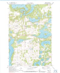
1970 Map of Dorset
USGS Topo · Published 1988About this map
Big Sand Lake and Lake Emma define the upper reaches of this Hubbard County landscape, where the glacial geography of Minnesota created an intricate network of waterways connected by the Sand River and Hellkamp Creek. The small settlement of Dorset sits along the Burlington Northern railroad line, featuring the Dorset Lookout Tower as a local landmark. Further south, the town of Nevis borders the expansive Lake Belle Taine, while the Crow Wing River system links several smaller water bodies including Fifth Crow Wing Lake and Sixth Crow Wing Lake. For those researching local heritage, the map identifies rural landmarks such as the Henrietta Cemetery and Bethel Cemetery, alongside several gravel pits that hint at the local economy and road-building efforts of the early 1970s.
Find a feature on this map
42 named features on this map. Tap any name to fly to it.
Don’t see what you’re looking for? This feature index may not catch every label — zoom into the map to look around manually.
Map Details
Editions of this 1970 Dorset Map
2 editions found

Other maps of this area

1953 · Brainerd
USGS Topo · 1:250,000

1954 · Bemidji
USGS Topo · 1:250,000

1957 · Brainerd
USGS Topo · 1:250,000

1957 · Bemidji
USGS Topo · 1:250,000

1958 · Bemidji
USGS Topo · 1:250,000

1958 · Brainerd
USGS Topo · 1:250,000

1965 · Brainerd
USGS Topo · 1:250,000

1969 · Park Rapids
USGS Topo · 1:24,000

1969 · Menahga
USGS Topo · 1:24,000

1970 · Nevis
USGS Topo · 1:24,000