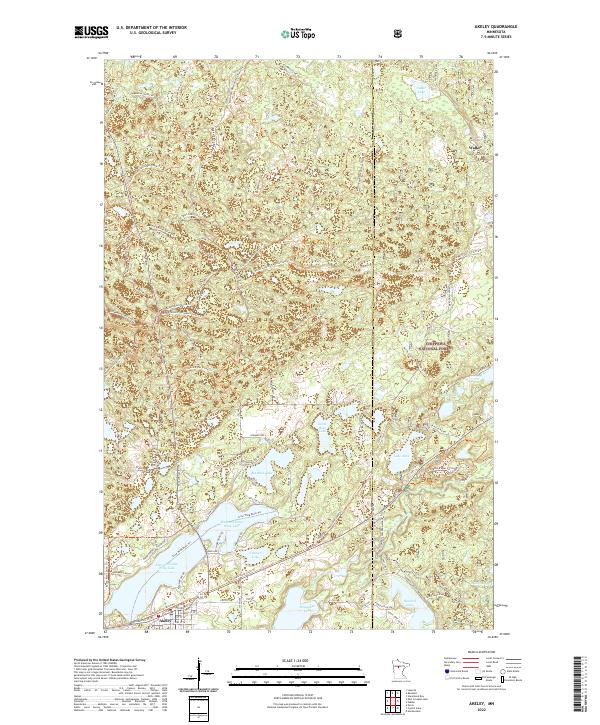
2022 Map of Akeley
USGS Topo · Published 2022About this map
Akeley stands at the southern edge of this Minnesota landscape, serving as a gateway to the dense woodlands of the Chippewa National Forest. The area is defined by a dense network of glacial lakes and river systems, most notably the Eleventh Crow Wing Lake and the Shingobee River which flows through Shingobee Lake. The map reveals a complex intersection of modern recreation and old forest infrastructure, where the Heartland State Trl and the North Country National Scenic Trl cross paths with numerous forest roads like Kabekona Forest Rd and Blue Trl. These trails follow the contours of a terrain shaped by water, connecting smaller bodies like Lake Alice and Little Bass Lake. The layout of Akeley itself is visible along the Heartland State Trl, showing the street grid including Broadway St W and Carroll St SE.
Find a feature on this map
58 named features on this map. Tap any name to fly to it.
Don’t see what you’re looking for? This feature index may not catch every label — zoom into the map to look around manually.
Map Details
Editions of this 2022 Akeley Map
This is the sole edition of this map. No revisions or reprints were ever made.
Other maps of this area

1953 · Brainerd
USGS Topo · 1:250,000

1954 · Bemidji
USGS Topo · 1:250,000

1957 · Brainerd
USGS Topo · 1:250,000

1957 · Bemidji
USGS Topo · 1:250,000

1958 · Bemidji
USGS Topo · 1:250,000

1958 · Brainerd
USGS Topo · 1:250,000

1965 · Brainerd
USGS Topo · 1:250,000

1970 · Hackensack
USGS Topo · 1:24,000

1970 · Nevis
USGS Topo · 1:24,000
1970 · Crystal Lake
USGS Topo · 1:24,000