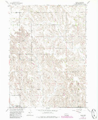
1954 Map of Akron
USGS Topo · Published 1985About this map
Akron and the surrounding Boone County landscape appear here as they were documented in the mid-1950s, with updates reflecting changes through the early 1980s. This region is characterized by a dense network of hills and drainages, where the U P Railroad railroad line cuts through the southern corner near the settlement of Primrose. The rural social fabric of the era is evidenced by the distribution of local institutions, including School No 59 and School No 47, which served the scattered farmsteads of the township.
Find a feature on this map
13 named features on this map. Tap any name to fly to it.
Don’t see what you’re looking for? This feature index may not catch every label — zoom into the map to look around manually.
Map Details
Editions of this 1954 Akron Map
Other maps of this area

1954 · Cedar Rapids
USGS Topo · 1:24,000

1954 · Spalding
USGS Topo · 1:24,000

1954 · Akron
USGS Topo · 1:24,000

1954 · Albion West
USGS Topo · 1:24,000

1954 · Cedar Rapids SE
USGS Topo · 1:24,000

1954 · Spalding SE
USGS Topo · 1:24,000

1955 · Broken Bow
USGS Topo · 1:250,000

1956 · Broken Bow
USGS Topo · 1:250,000

1960 · Spalding 2 SE
USGS Topo · 1:24,000

1963 · Petersburg
USGS Topo · 1:24,000