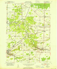
1951 Map of Akron
USGS Topo · Published 1951About this map
The Tonawanda Indian Reservation occupies the center of this 1951 survey, where Tonawanda Creek meanders through a landscape defined by Indigenous community sites and small rural hamlets. Key cultural landmarks include the Council House and the Tonawanda Indian Community Center, surrounded by numerous family and community burial grounds such as Long House Cem and Four Corners Cem. To the north, the terrain transitions into the Oak Orchard Swamp, while the southern portion of the map is anchored by the village of Akron, showing its concentrated street grid and Central School. The region's mid-century transportation network is dominated by the New York Central railroad, which services agricultural stops like Basom (Alabama Sta) and connects the larger settlements of Alabama and Indian Falls. This survey documents a specific intersection of state-managed land, such as the White Memorial State Game Farm, and established reservation life before significant modern development altered the rural character of Erie and Genesee Counties.
Find a feature on this map
44 named features on this map. Tap any name to fly to it.
Don’t see what you’re looking for? This feature index may not catch every label — zoom into the map to look around manually.
Map Details
Editions of this 1951 Akron Map
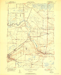
2 editions found
Other maps of this area

1897 · Medina
USGS Topo · 1:62,500

1897 · Lockport
USGS Topo · 1:62,500

1899 · Niagara
USGS Topo · 1:125,000

1902 · Lockport
USGS Topo · 1:62,500

1905 · Attica
USGS Topo · 1:62,500

1905 · Depew
USGS Topo · 1:62,500

1905 · Lockport
USGS Topo · 1:62,500

1944 · Alexander
USGS Topo · 1:31,680

1948 · Depew
USGS Topo · 1:62,500

1948 · Lockport
USGS Topo · 1:62,500