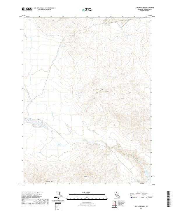
2021 Map of Al Shinn Canyon
USGS Topo · Published 2021About this map
Al Shinn Canyon cuts through the high desert terrain of Lassen County, where water is the primary architect of the landscape. This 2021 survey documents a remote corner of California defined by critical water sources such as Wagontire Spring, Stove Spring, and Horn Springs. These scattered reliable points of water, along with others like Petes Spring and Sage Hen Spring, indicate the historical importance of the area for livestock and transit through the arid basin. The drainage of Smoke Cr winds through the canyons, bounded to the south by the high points of Cherry Mtn and Rush Creek Mtn. Human presence is sparse, marked primarily by the unimproved path of Rye Patch Rd and the structured grid of the Public Land Survey System, showing the township boundaries of T33N and T32N across the landscape.
Find a feature on this map
14 named features on this map. Tap any name to fly to it.
Don’t see what you’re looking for? This feature index may not catch every label — zoom into the map to look around manually.
Map Details
Editions of this 2021 Al Shinn Canyon Map
This is the sole edition of this map. No revisions or reprints were ever made.
Other maps of this area

1886 · Honey Lake
USGS Topo · 1:250,000

1886 · Granite Range
USGS Topo · 1:250,000

1891 · Honey Lake
USGS Topo · 1:250,000

1893 · Honey Lake
USGS Topo · 1:250,000

1894 · Granite Range
USGS Topo · 1:250,000

1954 · Observation Peak
USGS Topo · 1:62,500

1954 · Shinn Mountain
USGS Topo · 1:62,500

1955 · Westwood
USGS Topo · 1:250,000

1955 · Lovelock
USGS Topo · 1:250,000

1958 · Westwood
USGS Topo · 1:250,000