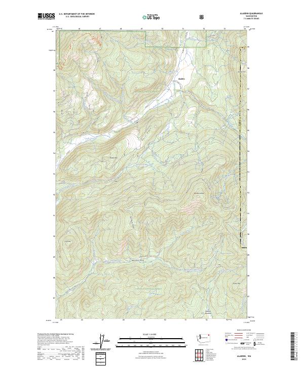
2023 Map of Aladdin
USGS Topo · Published 2023About this map
Aladdin serves as the focal point for this mountain landscape in Stevens County, where the topography is defined by significant elevations like Aladdin Mtn and Gillette Ridge. The map details the complex drainage systems within the Colville National Forest, featuring the headwaters of numerous creeks including South Fork Deep Creek and Middle Fork Mill Creek. These watercourses carve through the high terrain, separated by prominent landforms such as Eisler Ridge and Bon Ayre Ridge.
Find a feature on this map
41 named features on this map. Tap any name to fly to it.
Don’t see what you’re looking for? This feature index may not catch every label — zoom into the map to look around manually.
Map Details
Editions of this 2023 Aladdin Map
This is the sole edition of this map. No revisions or reprints were ever made.
Other maps of this area

1929 · Colville
USGS Topo · 1:125,000

1933 · Colville
USGS Topo · 1:125,000

1952 · Gillette Mtn
USGS Topo · 1:24,000

1952 · Spirit
USGS Topo · 1:24,000

1952 · Deep Lake
USGS Topo · 1:24,000

1952 · White Mud Lake
USGS Topo · 1:24,000

1952 · Aladdin
USGS Topo · 1:24,000

1958 · Sandpoint
USGS Topo · 1:250,000

1963 · Sandpoint
USGS Topo · 1:250,000
1966 · Aladdin
USGS Topo · 1:24,000