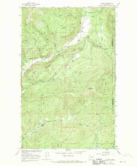
1966 Map of Aladdin
USGS Topo · Published 1969About this map
Aladdin serves as the central focal point for this mid-century survey of the high country along the Stevens and Pend Oreille County line. The landscape is defined by the heavy presence of mineral extraction, with the Morning Mine, Burrus Mine, and Aladdin Mine all positioned along the slopes of Aladdin Mountain. These industrial sites are linked by a network of drainage systems including Deep Creek and the headwaters of Mill Creek. Further south, the map reveals a more settled aspect of the high valleys, specifically within the Bon Ayre Valley. This area preserves the location of the Bon Ayre School and Bon Ayre Spring, indicating a pocket of community life tucked between the prominent heights of Ensley Ridge and Bon Ayre Ridge. The presence of Polley Cabin and various jeep trails suggests a region shaped by both persistent mining interests and isolated mountain living.
Find a feature on this map
37 named features on this map. Tap any name to fly to it.
Don’t see what you’re looking for? This feature index may not catch every label — zoom into the map to look around manually.
Map Details
Editions of this 1966 Aladdin Map
3 editions found
Other maps of this area

1929 · Colville
USGS Topo · 1:125,000

1933 · Colville
USGS Topo · 1:125,000

1952 · Gillette Mtn
USGS Topo · 1:24,000

1952 · Spirit
USGS Topo · 1:24,000

1952 · Deep Lake
USGS Topo · 1:24,000

1952 · White Mud Lake
USGS Topo · 1:24,000

1952 · Aladdin
USGS Topo · 1:24,000

1958 · Sandpoint
USGS Topo · 1:250,000

1963 · Sandpoint
USGS Topo · 1:250,000
1966 · Lake Gillette
USGS Topo · 1:24,000