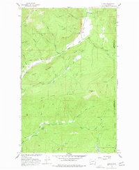
1966 Map of Aladdin
USGS Topo · Published 1977About this map
Aladdin serves as a central hub in this high-altitude landscape along the Stevens and Pend Oreille County line. The map highlights a robust mining history in the northern reaches of the quadrangle, where the Aladdin Mine, Morning Mine, and Burrus Mine are nestled into the steep slopes of Aladdin Mountain. These industrial sites represent the region's extraction-based economy during the mid-20th century, supported by a network of unimproved roads and a jeep trail system through the dense timber.
Find a feature on this map
39 named features on this map. Tap any name to fly to it.
Don’t see what you’re looking for? This feature index may not catch every label — zoom into the map to look around manually.
Map Details
Editions of this 1966 Aladdin Map
3 editions found
Other maps of this area

1929 · Colville
USGS Topo · 1:125,000

1933 · Colville
USGS Topo · 1:125,000

1952 · Gillette Mtn
USGS Topo · 1:24,000

1952 · Spirit
USGS Topo · 1:24,000

1952 · Deep Lake
USGS Topo · 1:24,000

1952 · White Mud Lake
USGS Topo · 1:24,000

1952 · Aladdin
USGS Topo · 1:24,000

1958 · Sandpoint
USGS Topo · 1:250,000

1963 · Sandpoint
USGS Topo · 1:250,000
1966 · Aladdin
USGS Topo · 1:24,000