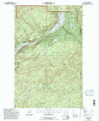
1992 Map of Aladdin
USGS Topo · Published 1996About this map
The tiny settlement of Aladdin anchors this portion of the Colville National Forest during the early 1990s, where the drainages of Meadow Creek and Deep Creek converge. The landscape is defined by significant topographical features like Aladdin Mountain and the expansive Bon Ayre Ridge, which separates the northern creek systems from the Bon Ayre Valley to the south. Historically, the area was tied to mineral extraction and education, evidenced by the Morning Mine and the Bon Ayre School.
Find a feature on this map
24 named features on this map. Tap any name to fly to it.
Don’t see what you’re looking for? This feature index may not catch every label — zoom into the map to look around manually.
Map Details
Editions of this 1992 Aladdin Map
This is the sole edition of this map. No revisions or reprints were ever made.
Other maps of this area

1929 · Colville
USGS Topo · 1:125,000

1933 · Colville
USGS Topo · 1:125,000

1952 · Gillette Mtn
USGS Topo · 1:24,000

1952 · Spirit
USGS Topo · 1:24,000

1952 · Deep Lake
USGS Topo · 1:24,000

1952 · White Mud Lake
USGS Topo · 1:24,000

1952 · Aladdin
USGS Topo · 1:24,000

1958 · Sandpoint
USGS Topo · 1:250,000

1963 · Sandpoint
USGS Topo · 1:250,000
1966 · Aladdin
USGS Topo · 1:24,000