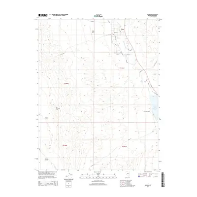
2015 Map of Alamo
USGS Topo · Published 2015About this map
Alamo serves as the focal point of this Nevada landscape, situated within the fertile Pahranagat Valley between the East Pahranagat Range and the waters of the Pahranagat Cr. The map details a community defined by its irrigation and aviation infrastructure, from the Alamo Company E Ditch that feeds the valley to the Alamo Landing Field located northwest of the town center. To the southeast, the terrain transitions into the wetlands of Upper Pahranagat Lake and the seclusion of Badger Valley. Local transportation is well-defined by a network of rural thoroughfares such as Old US 93 Rd and Sharp Ranch Rd, providing a clear view of how ranching and residence have shaped this part of Lincoln County. The presence of Grove Spring further highlights the critical role of water sources in this high-desert environment.
Find a feature on this map
32 named features on this map. Tap any name to fly to it.
Don’t see what you’re looking for? This feature index may not catch every label — zoom into the map to look around manually.
Map Details
Editions of this 2015 Alamo Map
This is the sole edition of this map. No revisions or reprints were ever made.
Other maps of this area

1945 · Alamo
USGS Topo · 1:125,000

1954 · Caliente
USGS Topo · 1:250,000

1959 · Caliente
USGS Topo · 1:250,000

1969 · Alamo SE
USGS Topo · 1:24,000

1969 · Lower Pahranagat Lake
USGS Topo · 1:24,000

1969 · Alamo NE
USGS Topo · 1:24,000
1969 · Lower Pahranagat Lake NW
USGS Topo · 1:24,000

1969 · Alamo
USGS Topo · 1:24,000

1969 · Ash Springs
USGS Topo · 1:24,000
1980 · Alamo
USGS Topo · 1:24,000