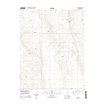
2014 Map of Alamo NE
USGS Topo · Published 2014About this map
Alamo sits at the southwestern edge of this high-desert basin, where the rugged Hiko Range and the South Pahroc Range create a dramatic corridor. Water is the defining constraint and lifeline of this landscape, evidenced by the series of critical watering points such as Sixmile Spring, Eightmile Spring, and Rye Patch Spring that dot the alluvial fans. These springs, alongside the Twin Spring Reservoir, provided essential support for livestock and travelers moving through the vast Eightmile Valley and across Sixmile Flat. The road network, including Hells Half Acre Rd and Twin Springs Rd, reflects the sparse but functional infrastructure required to navigate the basin-and-range topography. This 2014 survey documents the enduring ranching and hydrological features of Lincoln County, highlighting the geographic isolation and the strategic importance of every named water source in the arid Great Basin.
Find a feature on this map
22 named features on this map. Tap any name to fly to it.
Don’t see what you’re looking for? This feature index may not catch every label — zoom into the map to look around manually.
Map Details
Editions of this 2014 Alamo NE Map
This is the sole edition of this map. No revisions or reprints were ever made.
Other maps of this area

1885 · Pioche
USGS Topo · 1:250,000

1886 · Pioche
USGS Topo · 1:250,000

1945 · Alamo
USGS Topo · 1:125,000

1954 · Caliente
USGS Topo · 1:250,000

1959 · Caliente
USGS Topo · 1:250,000

1969 · Alamo SE
USGS Topo · 1:24,000

1969 · Alamo NE
USGS Topo · 1:24,000

1969 · Alamo
USGS Topo · 1:24,000

1969 · Delamar NW
USGS Topo · 1:24,000

1969 · Ash Springs
USGS Topo · 1:24,000