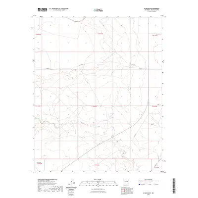
2023 Map of Alamo Ranch
USGS Topo · Published 2023About this map
Yeso Creek winds through this arid De Baca County landscape, serving as a primary drainage feature alongside the broad Alamo Draw. The area is defined by a sparse but deliberate network of local routes, including Renegade Rd and Altito Rd, which navigate the subtle changes in elevation across the high plains. A single water resource, Red Tank, stands out in the central portion of the quadrangle, illustrating the critical role of water management in this New Mexico rangeland. The map detail reflects a modern surveying of section lines and township boundaries such as t1n r25e, providing a precise look at the rural organization of the territory. The proximity of named roads like Cibola Rd and Roadrunner Rd suggests the continued importance of these corridors for local ranching and land access in the eastern plains.
Find a feature on this map
19 named features on this map. Tap any name to fly to it.
Don’t see what you’re looking for? This feature index may not catch every label — zoom into the map to look around manually.
Map Details
Editions of this 2023 Alamo Ranch Map
This is the sole edition of this map. No revisions or reprints were ever made.
Other maps of this area

1954 · Fort Sumner
USGS Topo · 1:250,000

1958 · Fort Sumner
USGS Topo · 1:250,000

1965 · Fort Sumner West
USGS Topo · 1:24,000

1966 · West Camp
USGS Topo · 1:24,000

1966 · Alamo Ranch
USGS Topo · 1:24,000

1966 · Ricardo
USGS Topo · 1:24,000

1967 · Eighteenmile Hill
USGS Topo · 1:24,000

1967 · Conejo Creek West
USGS Topo · 1:24,000
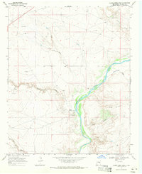
1967 · Conejo Creek East
USGS Topo · 1:24,000

1968 · Fort Sumner East
USGS Topo · 1:24,000