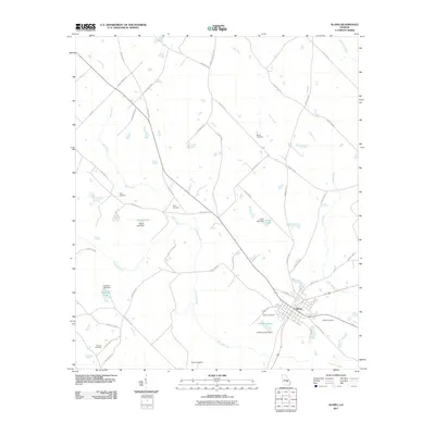
2011 Map of Alamo
USGS Topo · Published 2011About this map
The town of Alamo serves as the central hub of this Wheeler County landscape, where the street grid of Towns Ave, Oxford St, and Lucile Ave gives way to a network of rural routes. Water management is a defining characteristic of the surrounding countryside, evidenced by numerous man-made bodies of water such as Jordan Lake, Morris Lake, and O'Quinns Pond, each supported by its own dam. These reservoirs are fed by a complex drainage system including Alligator Creek, Buck Creek, and Little Creek.
Find a feature on this map
53 named features on this map. Tap any name to fly to it.
Don’t see what you’re looking for? This feature index may not catch every label — zoom into the map to look around manually.
Map Details
Editions of this 2011 Alamo Map
This is the sole edition of this map. No revisions or reprints were ever made.
Other maps of this area

1957 · Macon
USGS Topo · 1:250,000

1958 · Macon
USGS Topo · 1:250,000

1964 · Macon
USGS Topo · 1:250,000

1970 · Scotland
USGS Topo · 1:24,000

1970 · Glenwood
USGS Topo · 1:24,000

1970 · Alamo
USGS Topo · 1:24,000

1970 · Jordan
USGS Topo · 1:24,000

1971 · Lothair
USGS Topo · 1:24,000

1972 · Mc Rae NW
USGS Topo · 1:24,000
1972 · Mc Rae
USGS Topo · 1:24,000