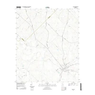
2014 Map of Alamo
USGS Topo · Published 2014About this map
The boundary between Laurens Co and Wheeler Co cuts diagonally across this landscape, where family history is deeply etched into the geography. Numerous burial grounds, including Clark Cem, Oak Grove Cem, and Smith Cem, are scattered across the terrain, serving as vital landmarks for genealogists and local historians. The area is defined by a dendritic network of waterways such as Alligator Creek, Buck Creek, and Little Creek, which feed into local bodies of water like Morris Lake and O'Quinns Pond. The road system, dominated by Ga-126 and several county routes like WH Gilder Farm Rd, connects these rural points, reflecting a land use pattern that remains focused on agriculture and small-scale timber tracts in the early 21st century.
Find a feature on this map
72 named features on this map. Tap any name to fly to it.
Don’t see what you’re looking for? This feature index may not catch every label — zoom into the map to look around manually.
Map Details
Editions of this 2014 Alamo Map
This is the sole edition of this map. No revisions or reprints were ever made.
Other maps of this area

1957 · Macon
USGS Topo · 1:250,000

1958 · Macon
USGS Topo · 1:250,000

1964 · Macon
USGS Topo · 1:250,000

1970 · Scotland
USGS Topo · 1:24,000

1970 · Glenwood
USGS Topo · 1:24,000

1970 · Alamo
USGS Topo · 1:24,000

1970 · Jordan
USGS Topo · 1:24,000

1971 · Lothair
USGS Topo · 1:24,000

1972 · Mc Rae NW
USGS Topo · 1:24,000
1972 · Mc Rae
USGS Topo · 1:24,000