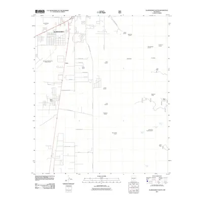
2011 Map of Alamogordo South
USGS Topo · Published 2011About this map
Alamogordo and its southward expansion define this desert landscape, where residential developments like Boles Acres and Omlee sit between significant aviation and military hubs. The sprawling footprint of Holloman Air Force Base occupies the central western portion of the map, while civil aviation is represented by the Alamogordo-White Sands Regional Airport and the Alamo Midway Airport to the north. To the east, the terrain rises sharply into the Sacramento Mountains, marked by a series of deep cuts including Alamo Canyon, Lead Canyon, and Muleshoe Canyon. This rugged transition from the Tularosa Basin floor to the higher peaks of Mule Peak is dotted with important water sources for the arid environment, such as Dripping Spring and Fairchild Spring. Local industry and land use are further evidenced by the Alamo Number Two Pit and named grazing areas like The Roundup Ground.
Find a feature on this map
50 named features on this map. Tap any name to fly to it.
Don’t see what you’re looking for? This feature index may not catch every label — zoom into the map to look around manually.
Map Details
Editions of this 2011 Alamogordo South Map
This is the sole edition of this map. No revisions or reprints were ever made.
Other maps of this area

1916 · Point Of Sands
USGS Topo · 1:125,000

1948 · Tres Hermanos
USGS Topo · 1:62,500

1948 · Holloman
USGS Topo · 1:62,500

1950 · Escondido Canyon
USGS Topo · 1:62,500

1950 · Alamogordo
USGS Topo · 1:62,500

1954 · Carlsbad
USGS Topo · 1:250,000

1955 · Las Cruces
USGS Topo · 1:250,000

1958 · Las Cruces
USGS Topo · 1:250,000

1958 · Carlsbad
USGS Topo · 1:250,000

1976 · Mule Peak
USGS Topo · 1:24,000