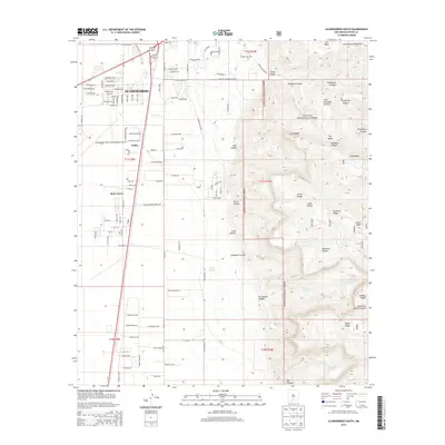
2013 Map of Alamogordo South
USGS Topo · Published 2013About this map
The southern fringes of Alamogordo and the burgeoning community of Boles Acres meet the dramatic ascent of the Sacramento Mountains in this 2013 survey. The landscape is sharply divided between the high desert floor, where suburban expansion reaches toward the Alamogordo White Sands Regional Airport, and the protected wilderness of the Lincoln National Forest. Moving east into the mountains, the map reveals a rugged network of canyons and ridges, including the prominent Steamboat formation and Mule Peak. This transition zone is marked by vital water sources in an arid climate, such as Dripping Spring and Fairchild Spring, which historically supported ranching and early settlement. The presence of The Roundup Ground and Taylor Tanks underscores the long-standing importance of this area for livestock management at the foot of the Dog Canyon entrance.
Find a feature on this map
109 named features on this map. Tap any name to fly to it.
Don’t see what you’re looking for? This feature index may not catch every label — zoom into the map to look around manually.
Map Details
Editions of this 2013 Alamogordo South Map
This is the sole edition of this map. No revisions or reprints were ever made.
Other maps of this area

1916 · Point Of Sands
USGS Topo · 1:125,000

1948 · Tres Hermanos
USGS Topo · 1:62,500

1948 · Holloman
USGS Topo · 1:62,500

1950 · Escondido Canyon
USGS Topo · 1:62,500

1950 · Alamogordo
USGS Topo · 1:62,500

1954 · Carlsbad
USGS Topo · 1:250,000

1955 · Las Cruces
USGS Topo · 1:250,000

1958 · Las Cruces
USGS Topo · 1:250,000

1958 · Carlsbad
USGS Topo · 1:250,000

1976 · Mule Peak
USGS Topo · 1:24,000