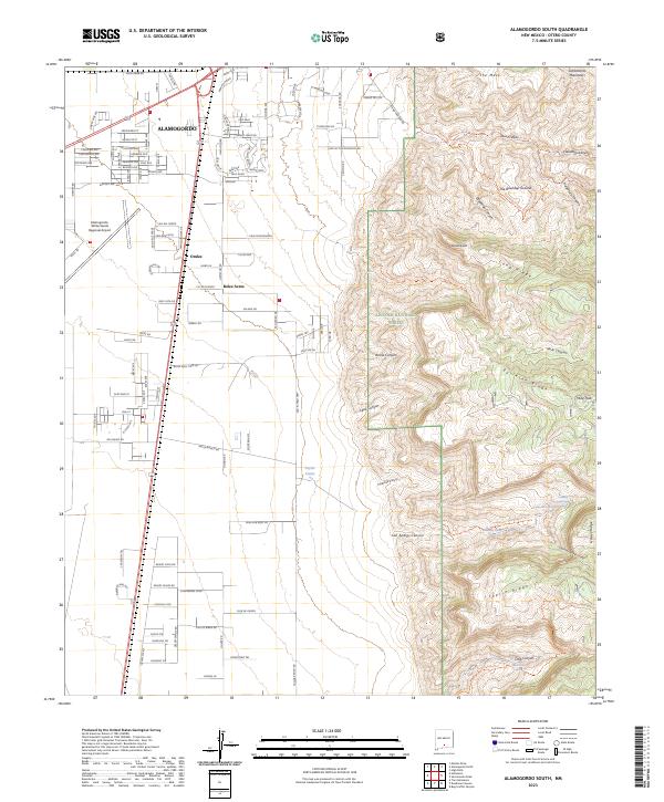
2023 Map of Alamogordo South
USGS Topo · Published 2023About this map
Alamogordo and its southern residential expansions dominate the western plains of this Otero County landscape, where urban grid-work meets the rising slopes of the Sacramento Mountains. The transition from city streets to the protected wilderness of the Lincoln National Forest is immediate and sharp, marked by a network of drainage systems like Alamo Canyon and Caballero Canyon that carve into the rugged eastern highlands.
Find a feature on this map
134 named features on this map. Tap any name to fly to it.
Don’t see what you’re looking for? This feature index may not catch every label — zoom into the map to look around manually.
Map Details
Editions of this 2023 Alamogordo South Map
This is the sole edition of this map. No revisions or reprints were ever made.
Other maps of this area

1916 · Point Of Sands
USGS Topo · 1:125,000

1948 · Tres Hermanos
USGS Topo · 1:62,500

1948 · Holloman
USGS Topo · 1:62,500

1950 · Escondido Canyon
USGS Topo · 1:62,500

1950 · Alamogordo
USGS Topo · 1:62,500

1954 · Carlsbad
USGS Topo · 1:250,000

1955 · Las Cruces
USGS Topo · 1:250,000

1958 · Las Cruces
USGS Topo · 1:250,000

1958 · Carlsbad
USGS Topo · 1:250,000

1976 · Mule Peak
USGS Topo · 1:24,000