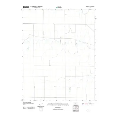
2009 Map of Alamota
USGS Topo · Published 2009About this map
Alamota sits at a crossroads in Lane County, where the high plains of western Kansas are etched by the winding drainages of the South Fork Walnut Creek and Darr Creek. This 2009 survey reveals a rural landscape organized by a strict geometric grid of section lines, where named local roads such as Scout, Turkey Red, and S Tomahawk provide access to the expansive agricultural tracts surrounding the central settlement. The map illustrates the specialized infrastructure of the region, notably Alamota Rd and Vista Rd, which facilitate the movement of goods and equipment across the vast prairie. The terrain is characterized by the subtle transition from flat tablelands to the more complex, dissected topography found immediately adjacent to the creek beds, reflecting the persistent role of water in shaping the development and accessibility of this portion of the Kansas plains.
Find a feature on this map
13 named features on this map. Tap any name to fly to it.
Don’t see what you’re looking for? This feature index may not catch every label — zoom into the map to look around manually.
Map Details
Editions of this 2009 Alamota Map
This is the sole edition of this map. No revisions or reprints were ever made.
Other maps of this area

1955 · Scott City
USGS Topo · 1:250,000

1958 · Scott City
USGS Topo · 1:250,000

1965 · Beeler
USGS Topo · 1:24,000

1965 · Utica SW
USGS Topo · 1:24,000

1974 · Dighton SW
USGS Topo · 1:24,000

1974 · Dighton
USGS Topo · 1:24,000

1974 · Alamota
USGS Topo · 1:24,000

1974 · Beeler SW
USGS Topo · 1:24,000

1974 · Dighton SE
USGS Topo · 1:24,000

1974 · Shields SE
USGS Topo · 1:24,000