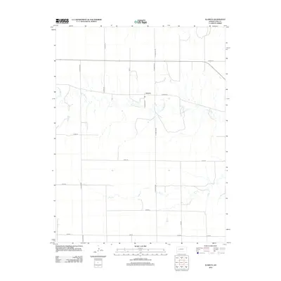
2012 Map of Alamota
USGS Topo · Published 2012About this map
Alamota sits at the heart of this Lane County landscape, where the agricultural grid is defined by a network of local roads and natural watercourses. The drainage of the S Fork Walnut Cr meanders across the central portion of the map, while Darr Cr flows through the southern section. This 2012 survey illustrates the enduring rural structure of western Kansas, marked by a precise system of section-line roads like S Tomahawk Rd and N Turkey Red Rd. The naming conventions of these routes, including S Rowdy Rd and S Quantum Rd, offer a unique glimpse into the local character and history of the region. Transportation is anchored by Alamota Rd and the throughway of route 96, connecting this remote settlement to the broader county economy.
Find a feature on this map
19 named features on this map. Tap any name to fly to it.
Don’t see what you’re looking for? This feature index may not catch every label — zoom into the map to look around manually.
Map Details
Editions of this 2012 Alamota Map
This is the sole edition of this map. No revisions or reprints were ever made.
Other maps of this area

1955 · Scott City
USGS Topo · 1:250,000

1958 · Scott City
USGS Topo · 1:250,000

1965 · Beeler
USGS Topo · 1:24,000

1965 · Utica SW
USGS Topo · 1:24,000

1974 · Dighton SW
USGS Topo · 1:24,000

1974 · Dighton
USGS Topo · 1:24,000

1974 · Alamota
USGS Topo · 1:24,000

1974 · Beeler SW
USGS Topo · 1:24,000

1974 · Dighton SE
USGS Topo · 1:24,000

1974 · Shields SE
USGS Topo · 1:24,000