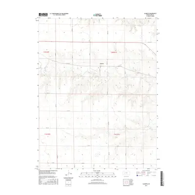
2015 Map of Alamota
USGS Topo · Published 2015About this map
Alamota sits at the center of this High Plains landscape, a small settlement defined by its position along the east-west corridor of Alamota Rd. The geography is characterized by the drainage patterns of the S Fork Walnut Cr and Darr Cr, which carve subtle valleys across the Kansas terrain. This 2015 survey reveals a strictly organized grid of rural infrastructure, where naming conventions like Rowdy Rd, Turkey Rd, and Wild Cat Ln suggest the local character and wildlife of Lane County. The map provides a precise view of the Public Land Survey System divisions, including t18s r28w and t18s r27w, which have dictated the placement of homesteads and section-line roads for generations.
Find a feature on this map
19 named features on this map. Tap any name to fly to it.
Don’t see what you’re looking for? This feature index may not catch every label — zoom into the map to look around manually.
Map Details
Editions of this 2015 Alamota Map
This is the sole edition of this map. No revisions or reprints were ever made.
Other maps of this area

1955 · Scott City
USGS Topo · 1:250,000

1958 · Scott City
USGS Topo · 1:250,000

1965 · Beeler
USGS Topo · 1:24,000

1965 · Utica SW
USGS Topo · 1:24,000

1974 · Dighton SW
USGS Topo · 1:24,000

1974 · Dighton
USGS Topo · 1:24,000

1974 · Alamota
USGS Topo · 1:24,000

1974 · Beeler SW
USGS Topo · 1:24,000

1974 · Dighton SE
USGS Topo · 1:24,000

1974 · Shields SE
USGS Topo · 1:24,000