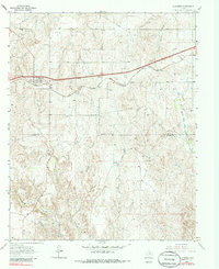
1963 Map of Alanreed
USGS Topo · Published 1986About this map
Alanreed serves as the primary hub of this 1960s Panhandle landscape, positioned where the Chicago Rock Island and Pacific railroad and the historic Route 66 corridor cross the plains. The map reveals a transition from the level uplands of Gray County into the deeply dissected breaks of Donley County to the south. This rugged drainage system is defined by a series of southward-flowing waterways, including Whitefish Creek, Mitchell Creek, and Parks Creek, which carve intricate relief into the terrain. Industrial activity is concentrated near the settlement, noted by several Gravel Pits and a local Cem that speak to the long-standing community footprint in this part of the Texas Panhandle. The presence of numerous gas wells and pipelines across the northern half of the sheet reflects the era's intensifying energy infrastructure, while the lower portion of the map remains dominated by open ranch land and natural drainages like Spring Creek.
Find a feature on this map
16 named features on this map. Tap any name to fly to it.
Don’t see what you’re looking for? This feature index may not catch every label — zoom into the map to look around manually.
Map Details
Editions of this 1963 Alanreed Map
2 editions found
Other maps of this area

1954 · Amarillo
USGS Topo · 1:250,000

1958 · Amarillo
USGS Topo · 1:250,000

1959 · Troublesome Creek
USGS Topo · 1:24,000

1959 · Spencer Lake
USGS Topo · 1:24,000

1962 · Griffin Ranch
USGS Topo · 1:24,000

1962 · Hudgens Ranch
USGS Topo · 1:24,000

1962 · Back
USGS Topo · 1:24,000

1963 · Alanreed
USGS Topo · 1:24,000

1963 · McLean
USGS Topo · 1:24,000

1964 · Rockledge
USGS Topo · 1:24,000