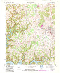
1978 Map of Albany
USGS Topo · Published 1983About this map
Albany serves as the focal point of this Clinton County survey, showing the town's mid-century expansion through the inclusion of the Albany Airport, Clinton County High Sch, and the County Fairgrounds. The landscape is defined by the sharp transition from the elevated Hogback Ridge and Huddleston Mountain to the deeply carved river valleys of the south. The creation of Dale Hollow Lake and Lake Wolf River dominates the bottom of the sheet, where the Kentucky Tennessee state line crosses the water near Huntersville. Away from the town center, numerous family and community landmarks such as Browns Crossroads, Dicken Chapel, and Memorial Hill Cem provide essential data for genealogists. The presence of active Oil Wells and Gas Fields along Illwill Creek in the northwest corner highlights the importance of mineral extraction to the local economy during this era.
Find a feature on this map
55 named features on this map. Tap any name to fly to it.
Don’t see what you’re looking for? This feature index may not catch every label — zoom into the map to look around manually.
Map Details
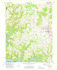
Editions of this 1978 Albany Map
2 editions found
Other maps of this area

1924 · Lillydale
USGS Topo · 1:62,500

1926 · Lillydale
USGS Topo · 1:62,500

1929 · Lillydale
USGS Topo · 1:62,500

1929 · Byrdstown
USGS Topo · 1:62,500

1953 · Burkesville
USGS Topo · 1:24,000

1953 · Wolf Creek Dam
USGS Topo · 1:24,000

1954 · Frogue
USGS Topo · 1:24,000

1954 · Cumberland City
USGS Topo · 1:24,000

1954 · Albany
USGS Topo · 1:24,000

1954 · Savage
USGS Topo · 1:24,000