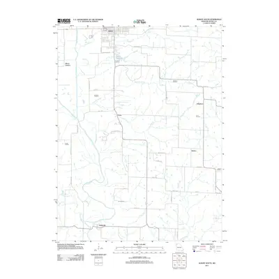
2011 Map of Albany South
USGS Topo · Published 2011About this map
The Grand River and its major tributary, the East Fork Grand River, dictate the topography of this Gentry County landscape. South of the city of Albany, the river system creates a network of branches including Thompson Branch, Jones Branch, and Stillhouse Branch. The settlement pattern is defined by small, historically significant communities such as Evona, Effingham, Whitten, and Gentryville, many of which grew around early rural road junctions and stream crossings. Genealogists will find a high concentration of burial grounds throughout the area, including Shepherd Cemetery near Curt Lee Lake, Sandville Cemetery, and Fore Cemetery. The map also captures specialized local markers like Whitten Switch and Camp Woodland Ln, reflecting a landscape transitioned from early pioneer homesteads to modern agricultural parcels and recreational sites.
Find a feature on this map
44 named features on this map. Tap any name to fly to it.
Don’t see what you’re looking for? This feature index may not catch every label — zoom into the map to look around manually.
Map Details
Editions of this 2011 Albany South Map
This is the sole edition of this map. No revisions or reprints were ever made.
Other maps of this area

1925 · Pattonsburg
USGS Topo · 1:62,500

1925 · Darlington
USGS Topo · 1:62,500

1942 · Grant City
USGS Topo · 1:62,500

1943 · Grant City
USGS Topo · 1:62,500

1944 · Pattonsburg
USGS Topo · 1:62,500

1946 · Pattonsburg
USGS Topo · 1:48,000

1948 · Bethany
USGS Topo · 1:62,500

1948 · Pattonsburg
USGS Topo · 1:62,500

1950 · Darlington
USGS Topo · 1:62,500

1955 · Nebraska City
USGS Topo · 1:250,000