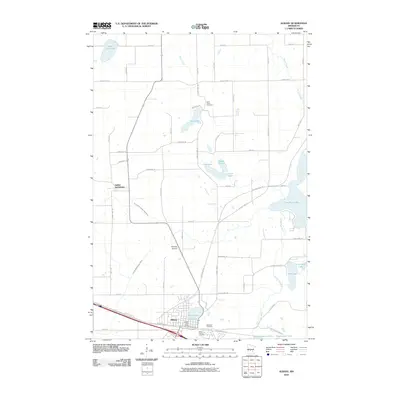
2010 Map of Albany
USGS Topo · Published 2010About this map
Albany and the smaller settlement of Saint Anthony anchor this Central Minnesota landscape during the first decade of the 21st century. The map reveals a transition from traditional rail-corridor development to modern recreation, most notably with the Lake Wobegon Trl tracing the path of former railroad lines through the heart of the region. This conversion reflects a shift in the local economy, connecting the main town site near North Lake to the surrounding countryside.
Find a feature on this map
55 named features on this map. Tap any name to fly to it.
Don’t see what you’re looking for? This feature index may not catch every label — zoom into the map to look around manually.
Map Details
Editions of this 2010 Albany Map
This is the sole edition of this map. No revisions or reprints were ever made.
Other maps of this area

1948 · Little Falls
USGS Topo · 1:62,500

1950 · Swanville
USGS Topo · 1:62,500

1950 · Little Falls
USGS Topo · 1:62,500

1953 · Saint Cloud
USGS Topo · 1:250,000

1957 · Saint Cloud
USGS Topo · 1:250,000

1958 · Saint Cloud
USGS Topo · 1:250,000

1965 · Albany
USGS Topo · 1:24,000

1965 · Farming
USGS Topo · 1:24,000

1965 · Holdingford
USGS Topo · 1:24,000

1965 · Freeport
USGS Topo · 1:24,000
Featured Places
- Albany, MN
- St. Anthony, MN
- Saint Anthony, St. Anthony
- Shamrock Mobile Home Park, Albany
- Stearns County, MN