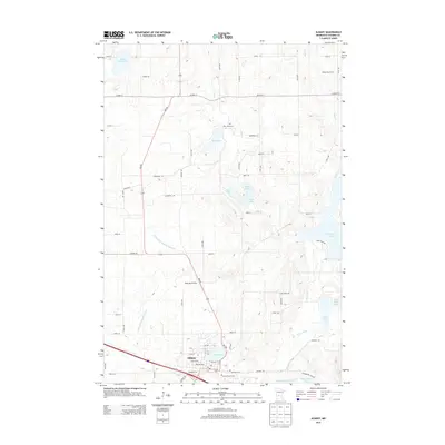
2013 Map of Albany
USGS Topo · Published 2013About this map
The settlement of Albany serves as the focal point of this Stearns County landscape, where the intersection of state and local highways anchors a dense network of farmsteads and rural infrastructure. The mapping reveals a complex glacial topography defined by numerous kettle lakes and managed drainage systems, including County Ditch Number Twentytwo and County Ditch Number Fifteen. Local history is preserved through established family and community landmarks, such as the Warga Dairy Farm and Skalicky Airstrip. The distribution of several burial grounds, including Seven Dolors Cem, Saint Johns Cem, and Ebenezer Cem, reflects the long-standing community ties in this central Minnesota region. A series of interconnected water bodies like Two River Lake and Bear Lake highlight the characteristic lake-studded terrain that has shaped local agriculture and recreation for generations.
Find a feature on this map
52 named features on this map. Tap any name to fly to it.
Don’t see what you’re looking for? This feature index may not catch every label — zoom into the map to look around manually.
Map Details
Editions of this 2013 Albany Map
This is the sole edition of this map. No revisions or reprints were ever made.
Other maps of this area

1948 · Little Falls
USGS Topo · 1:62,500

1950 · Swanville
USGS Topo · 1:62,500

1950 · Little Falls
USGS Topo · 1:62,500

1953 · Saint Cloud
USGS Topo · 1:250,000

1957 · Saint Cloud
USGS Topo · 1:250,000

1958 · Saint Cloud
USGS Topo · 1:250,000

1965 · Albany
USGS Topo · 1:24,000

1965 · Farming
USGS Topo · 1:24,000

1965 · Holdingford
USGS Topo · 1:24,000

1965 · Freeport
USGS Topo · 1:24,000
Featured Places
- Albany, MN
- St. Anthony, MN
- Saint Anthony, St. Anthony
- Shamrock Mobile Home Park, Albany
- Stearns County, MN