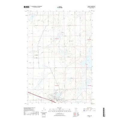
2019 Map of Albany
USGS Topo · Published 2019About this map
Albany anchors the southern edge of this Stearns County landscape, where the local infrastructure follows a legacy of transit and agriculture. The presence of Soo Line Ave reflects the historical path of the Soo Line Railroad, which influenced the growth of central Minnesota towns. To the north, the small settlement of St. Anthony is situated amidst a dense network of water bodies, including Saint Anna Lake, Two River Lake, and Bear Lake. These lakes are interconnected by a system of waterways such as the S Two River and managed channels like County Ditch Number Twenty-two. Genealogists will find significant local history at several burial sites, notably Seven Dolors Cem, Saint Johns Cem, and Ebenezer Cem, which serve as quiet landmarks for the area's early families and established parishes.
Find a feature on this map
85 named features on this map. Tap any name to fly to it.
Don’t see what you’re looking for? This feature index may not catch every label — zoom into the map to look around manually.
Map Details
Editions of this 2019 Albany Map
This is the sole edition of this map. No revisions or reprints were ever made.
Other maps of this area

1948 · Little Falls
USGS Topo · 1:62,500

1950 · Swanville
USGS Topo · 1:62,500

1950 · Little Falls
USGS Topo · 1:62,500

1953 · Saint Cloud
USGS Topo · 1:250,000

1957 · Saint Cloud
USGS Topo · 1:250,000

1958 · Saint Cloud
USGS Topo · 1:250,000

1965 · Albany
USGS Topo · 1:24,000

1965 · Farming
USGS Topo · 1:24,000

1965 · Holdingford
USGS Topo · 1:24,000

1965 · Freeport
USGS Topo · 1:24,000
Featured Places
- Albany, MN
- St. Anthony, MN
- Saint Anthony, St. Anthony
- Shamrock Mobile Home Park, Albany
- Stearns County, MN