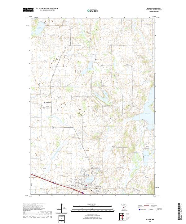
2022 Map of Albany
USGS Topo · Published 2022About this map
The city of Albany serves as the focal point for this section of Stearns County, situated at the intersection of a complex local road network and adjacent to the waters of North Lake. This area of central Minnesota is characterized by a dense concentration of glacial lakes and intricate drainage systems, including County Ditch Number Fifteen and County Ditch Number Twenty-two, which feed into larger bodies like Two River Lake and Saint Anna Lake. Genealogists will find significant value in the documentation of local burial sites, specifically Seven Dolors Cem, Saint Johns Cem, and Ebenezer Cem, which are primary identifiers for the early families of the region. To the northwest, the smaller settlement of St. Anthony marks a distinct rural node. The landscape is further defined by the meandering course of Krain Creek and the South Two River, illustrating the water-rich topography that has influenced the agricultural and residential development patterns of the township.
Find a feature on this map
83 named features on this map. Tap any name to fly to it.
Don’t see what you’re looking for? This feature index may not catch every label — zoom into the map to look around manually.
Map Details
Editions of this 2022 Albany Map
This is the sole edition of this map. No revisions or reprints were ever made.
Other maps of this area

1948 · Little Falls
USGS Topo · 1:62,500

1950 · Swanville
USGS Topo · 1:62,500

1950 · Little Falls
USGS Topo · 1:62,500

1953 · Saint Cloud
USGS Topo · 1:250,000

1957 · Saint Cloud
USGS Topo · 1:250,000

1958 · Saint Cloud
USGS Topo · 1:250,000

1965 · Albany
USGS Topo · 1:24,000

1965 · Farming
USGS Topo · 1:24,000

1965 · Holdingford
USGS Topo · 1:24,000

1965 · Freeport
USGS Topo · 1:24,000
Featured Places
- Albany, MN
- St. Anthony, MN
- Saint Anthony, St. Anthony
- Shamrock Mobile Home Park, Albany
- Stearns County, MN