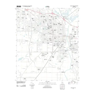
2011 Map of Albany West
USGS Topo · Published 2011About this map
The Flint River corridor and its surrounding suburban growth define this 2011 survey of western Albany. The landscape is heavily marked by institutional and community landmarks, including the sprawling Southwest Georgia Regional Airport and the Herty State Nursery. Water features are prominent throughout the quadrangle, from the large expanse of Lake Worth and the Flint River Dam in the northeast to smaller bodies like Willow Lake and Rawls Pond. The map serves as a valuable resource for local historians and genealogists, clearly labeling several large interment sites such as Crown Hill Cemetery, Riverside Cemetery, and Floral Memory Gardens. Residential development patterns are evident in the dense network of subdivisions including Sherwood Acres, Dawson Heights, and Palmyra Acres, while the eastern edge of the map reveals geological interest with the Fossil Sand Dunes located near the riverbank.
Find a feature on this map
148 named features on this map. Tap any name to fly to it.
Don’t see what you’re looking for? This feature index may not catch every label — zoom into the map to look around manually.
Map Details
Editions of this 2011 Albany West Map
This is the sole edition of this map. No revisions or reprints were ever made.
Other maps of this area

1953 · Dothan
USGS Topo · 1:250,000

1954 · Dothan
USGS Topo · 1:250,000

1955 · Dothan
USGS Topo · 1:250,000

1956 · Albany East
USGS Topo · 1:24,000

1956 · Albany West
USGS Topo · 1:24,000

1956 · Baconton
USGS Topo · 1:62,500

1956 · Newton
USGS Topo · 1:62,500

1956 · Sasser
USGS Topo · 1:62,500

1956 · Albany
USGS Topo · 1:62,500

1973 · Sasser
USGS Topo · 1:24,000