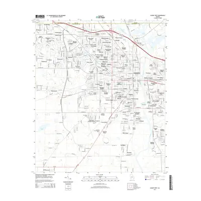
2014 Map of Albany West
USGS Topo · Published 2014About this map
Albany's western suburbs and industrial corridors are documented here, showing the city's growth toward the Southwest Georgia Regional Airport. The landscape is characterized by established residential neighborhoods such as Gailshar Gardens, Sherwood Acres, and Palmyra Heights, which fill the spaces between major thoroughfares like N Westover Blvd and Gillionville Rd. To the east, the Flint River forms a significant geographical boundary, winding past Lake Worth and through Viola Bend, where the terrain transitions toward the city's central core.
Find a feature on this map
127 named features on this map. Tap any name to fly to it.
Don’t see what you’re looking for? This feature index may not catch every label — zoom into the map to look around manually.
Map Details
Editions of this 2014 Albany West Map
This is the sole edition of this map. No revisions or reprints were ever made.
Other maps of this area

1953 · Dothan
USGS Topo · 1:250,000

1954 · Dothan
USGS Topo · 1:250,000

1955 · Dothan
USGS Topo · 1:250,000

1956 · Albany East
USGS Topo · 1:24,000

1956 · Albany West
USGS Topo · 1:24,000

1956 · Baconton
USGS Topo · 1:62,500

1956 · Newton
USGS Topo · 1:62,500

1956 · Sasser
USGS Topo · 1:62,500

1956 · Albany
USGS Topo · 1:62,500

1973 · Sasser
USGS Topo · 1:24,000