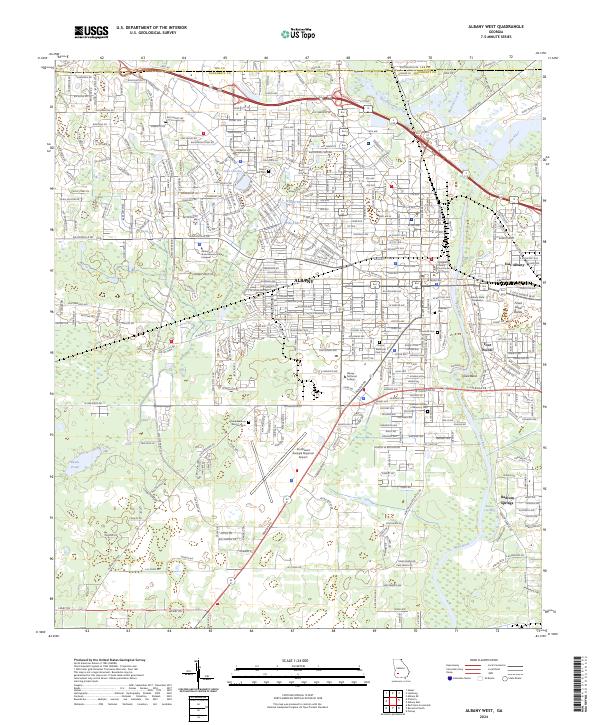
2024 Map of Albany West
USGS Topo · Published 2024About this map
Albany serves as the focal point of this southwestern Georgia survey, where the Flint River flows past the Dougherty County Courthouse and under several major crossings. The landscape is defined by its educational and civic institutions, featuring both the Albany State University West Campus and the primary Albany State University grounds near the river. Significant land use is dedicated to remembrance, with large plots for Crown Hill Cem, Floral Memory Gardens Cem, and Riverside Cem distributed across the city's residential peripheries.
Find a feature on this map
42 named features on this map. Tap any name to fly to it.
Don’t see what you’re looking for? This feature index may not catch every label — zoom into the map to look around manually.
Map Details
Editions of this 2024 Albany West Map
This is the sole edition of this map. No revisions or reprints were ever made.
Other maps of this area

1953 · Dothan
USGS Topo · 1:250,000

1954 · Dothan
USGS Topo · 1:250,000

1955 · Dothan
USGS Topo · 1:250,000

1956 · Albany East
USGS Topo · 1:24,000

1956 · Albany West
USGS Topo · 1:24,000

1956 · Baconton
USGS Topo · 1:62,500

1956 · Newton
USGS Topo · 1:62,500

1956 · Sasser
USGS Topo · 1:62,500

1956 · Albany
USGS Topo · 1:62,500

1973 · Sasser
USGS Topo · 1:24,000