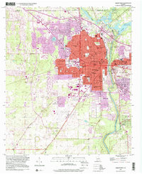
1997 Map of Albany West
USGS Topo · Published 2001About this map
The Flint River carves a deep path through the center of this Georgia landscape, serving as the eastern boundary for the core of Albany. By the late 1990s, the city's western expansion reached the Albany Dougherty County Airport, while the urban grid remained anchored by institutional landmarks such as Albany State College and the Hazard Training Sch. The terrain is marked by significant hydrological features including the northern Lake Chehaw and the southern Radium Springs, which highlight the region's reliance on both river and subterranean water sources. Along the riverbanks, distinct topographical features like the Fossil Sand Dunes and Viola Bend contrast with the dense network of schools and cemeteries. This era shows a mature municipal structure, with numerous neighborhood schools like Monroe High Sch and Highland Sch serving a growing population that pushed outward toward the State Nursery and Herty.
Find a feature on this map
64 named features on this map. Tap any name to fly to it.
Don’t see what you’re looking for? This feature index may not catch every label — zoom into the map to look around manually.
Map Details
Editions of this 1997 Albany West Map
This is the sole edition of this map. No revisions or reprints were ever made.
Other maps of this area

1953 · Dothan
USGS Topo · 1:250,000

1954 · Dothan
USGS Topo · 1:250,000

1955 · Dothan
USGS Topo · 1:250,000

1956 · Albany East
USGS Topo · 1:24,000

1956 · Albany West
USGS Topo · 1:24,000

1956 · Baconton
USGS Topo · 1:62,500

1956 · Newton
USGS Topo · 1:62,500

1956 · Sasser
USGS Topo · 1:62,500

1956 · Albany
USGS Topo · 1:62,500

1973 · Sasser
USGS Topo · 1:24,000